Staying safe in the winter requires special knowledge of the weather and the terrain where you are going.
There are several ways you can get the most current weather information and forecasts:
This excerpt from The Digital Hiker's Guide to Washington identifies links to web sites that have critical information you need to plan your trip carefully. Visit these sites to identify and take into consideration the many factors that need to be addressed to stay safe.
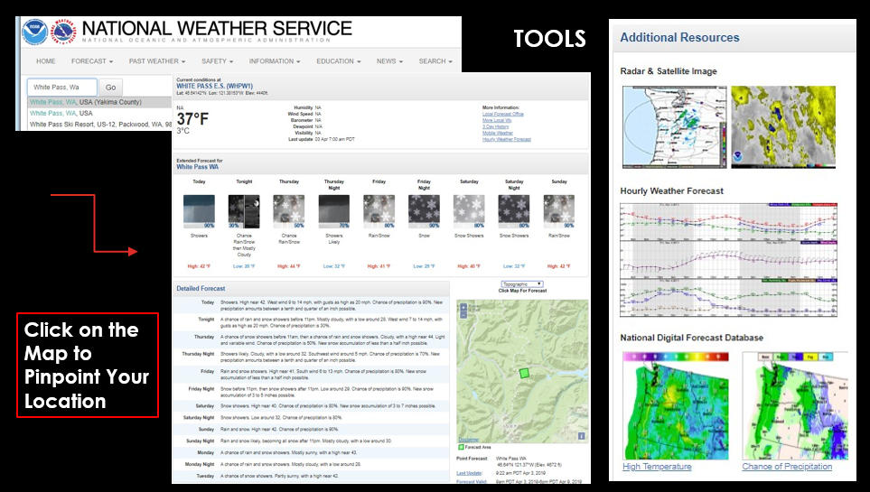
National Weather Service Pinpoint Forecast
NOAA (National Weather Service)
Open the map and point your cursor directly to a specific location. Use the zoom and drag tools to get to the location you need, or enter the name of the location in the text box to search. Look at the graphical information and tailor it to get the information you need.
Learning how to interpret weather forecasts is a very important digital hiker skill. There are lots of weather apps you can use. Knowing how to read the maps is essential to trip planning and remaining out of harms’ way.
US Forest Service Snow Depth Interactive Map
The Forest Service operates a digital interactive snow depth mapping system that covers the nation. The mapping system integrates a variety of data from on the ground and satellite sources. Those who pursue outdoor adventures in the winter time need to learn about avalanche safety and pay close attention to avalanche hazard warnings and conditions, especially in the mountains.
US Forest Service Snow Depth Map
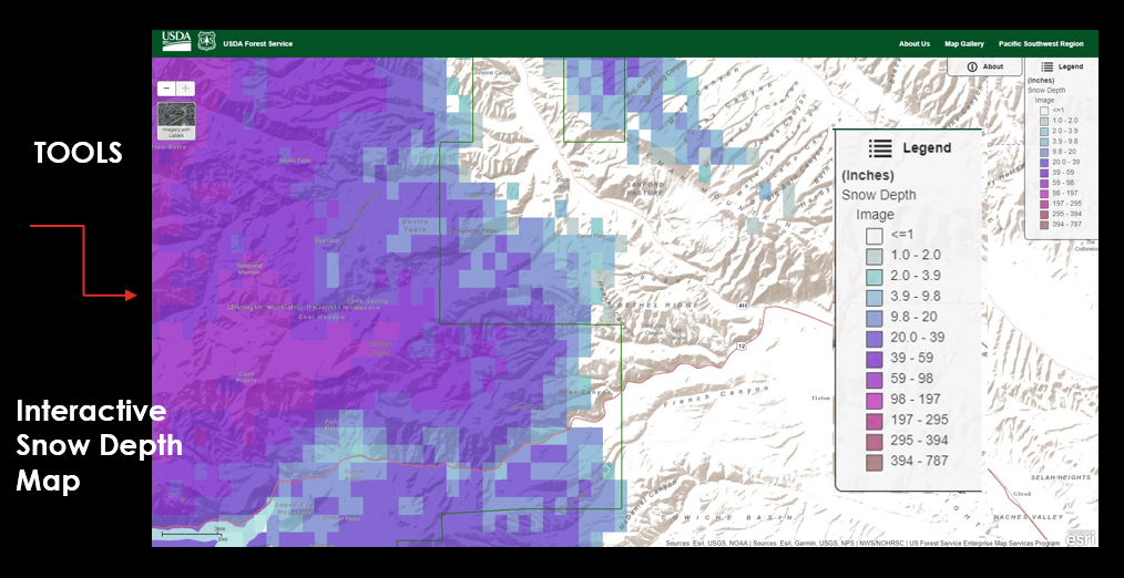
Staying aware of the weather forecast, snow conditions and avalanche safety factors is critical to preparing to take the right clothes and equipment with you.
Interpreting weather forecasts hiking
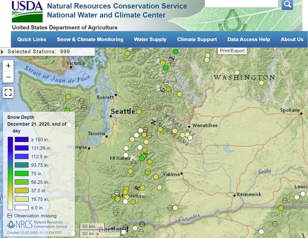
Snotel Snow Depth Interactive Maps
The Snotel Data System captures real time data from on the ground snow depth monitoring systems installed at numerous locations all over the state.
The USDA operates the SNOTEL data system which transmit snow depth and quality information from a network of stations using satellite telemetry.
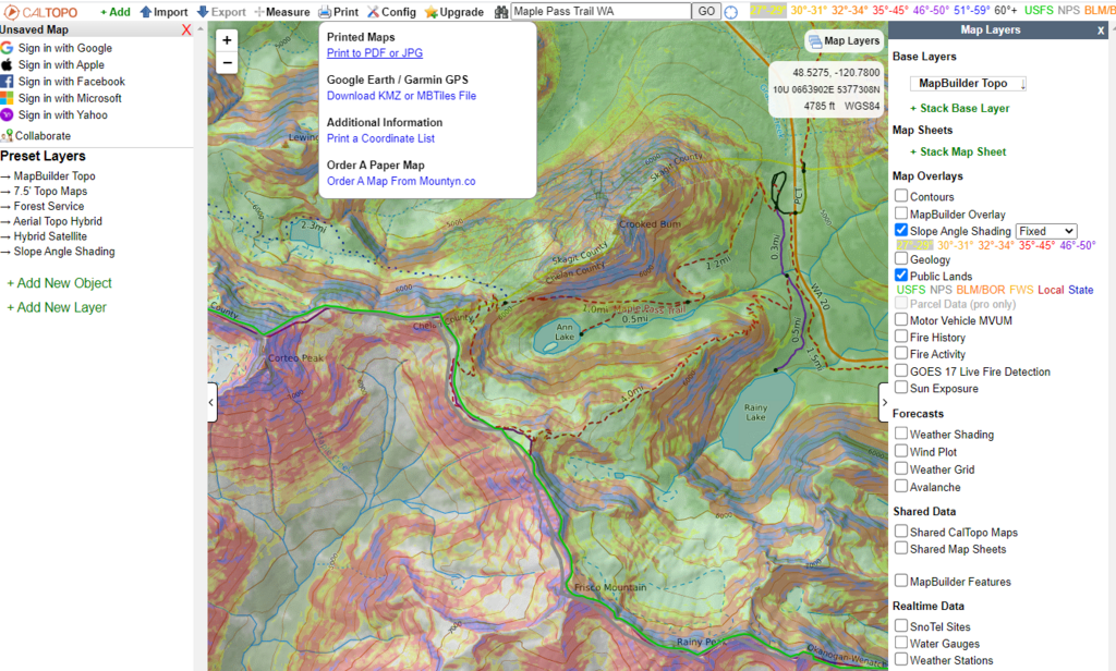
Cal Topo Maps
CalTopo map with public lands, slope angle shading and the MapBuilder layers turned on. CalTopo can be used to do very detailed trip planning.
This map of Maple Pass in North Cascades National Park has the trails from the MapBuilder Topo, the slope angle shading on to identify the steep terrain, and the Public Lands switch on. These are some of the data layers that can provide essential data to maximize safety, especially in winter. Then take a screenshot or print and save the page as a pdf.
Avalanche Safety Reports and Warnings
You can learn a lot more by studying the guidance and information available in the following links. The latest reports and warning is available at the avalanche centers in each region or county.
Avalanche Hazard Reports Washington
Digital Hiker Tip: Open and save these live links as icons or bookmarks on your desktop, laptop and cell phone!
Invest some time and get familiar with what each of these sites is capable of providing you for trip planning.
Learn how to open up the tools and explore the many options each map system offers.
Learn how to use the maps and they many life-saving tools they offer.
Excerpted from The Digital Hiker's Guide to Washington.